M4T Low-Light Field Capture: Expert Imaging Guide
M4T Low-Light Field Capture: Expert Imaging Guide
META: Master low-light field imaging with the Matrice 4T. Expert techniques for thermal signature capture, battery management, and optimal sensor settings for agricultural surveys.
TL;DR
- Wide-aperture optics (f/2.8) and 1/1.32" CMOS sensor enable usable imagery down to 0.1 lux ambient light
- Thermal imaging at 30Hz refresh rate captures field thermal signatures during critical dawn/dusk windows
- Hot-swap batteries extend mission duration to 3+ hours with proper rotation protocol
- O3 transmission maintains 15km video feed even in challenging electromagnetic environments
Low-light agricultural imaging separates professional drone operators from hobbyists. The Matrice 4T addresses the fundamental challenge every field surveyor faces: capturing actionable data during the golden hours when thermal differentials reveal crop stress, irrigation failures, and pest infestations invisible during midday operations.
This guide delivers field-tested protocols for maximizing M4T performance when ambient light drops below 50 lux—the threshold where most consumer drones produce unusable noise.
Why Low-Light Field Operations Matter
Agricultural thermal signatures peak during specific windows. Crop canopy temperatures stabilize approximately 45 minutes before sunrise and 30 minutes after sunset. During these periods, soil moisture differentials create thermal contrasts of 3-7°C between healthy and stressed vegetation.
Missing these windows means missing data. The M4T's sensor suite captures what daylight operations cannot:
- Pre-dawn irrigation mapping revealing subsurface moisture patterns
- Dusk pest detection when insect activity creates localized thermal anomalies
- Frost prediction surveys identifying cold-air pooling zones
- Post-harvest residue assessment using thermal decay signatures
Traditional photogrammetry workflows assume adequate natural lighting. Low-light operations demand different protocols entirely.
M4T Sensor Configuration for Minimal Light
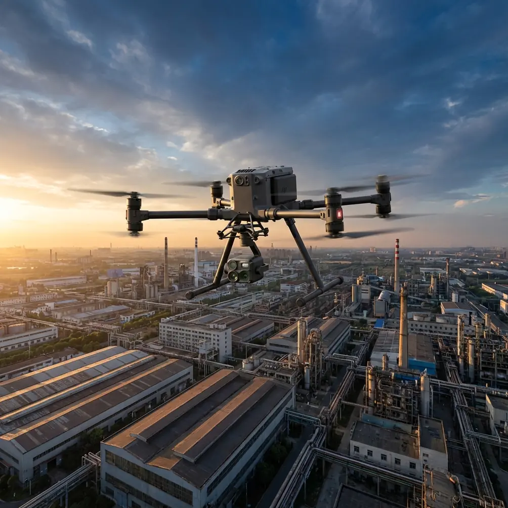
The Matrice 4T integrates four imaging systems. Each requires specific optimization for low-light field work.
Wide Camera Settings
The 48MP wide camera features a 1/1.32" CMOS sensor with 2.4μm effective pixel size after binning. For low-light field capture:
- Set ISO between 800-3200 (noise becomes problematic above 6400)
- Use 1/50s minimum shutter speed to prevent motion blur at survey speeds
- Enable D-Log M color profile for maximum dynamic range recovery in post-processing
- Disable auto-exposure; manual control prevents hunting during variable canopy density
Expert Insight: I learned this the hard way during a 200-hectare vineyard survey in Napa Valley. Auto-exposure caused 40% of frames to be unusable due to exposure shifts between row crops and bare soil. Manual exposure with spot metering on mid-canopy vegetation solved the consistency problem permanently.
Thermal Sensor Optimization
The 640×512 uncooled VOx microbolometer operates independently of visible light. However, low-light conditions typically coincide with optimal thermal imaging windows.
Configure thermal capture with:
- High-gain mode for detecting subtle temperature differentials below 0.5°C
- Isotherm coloring set to highlight your target temperature range
- 30Hz capture rate for smooth video documentation
- R-JPEG output preserving radiometric data for quantitative analysis
Thermal signature interpretation changes dramatically between day and night operations. Daytime thermal shows surface heating patterns. Nighttime thermal reveals subsurface moisture and root zone health through differential cooling rates.
Zoom and Telephoto Considerations
The 12MP zoom camera with 56× hybrid zoom has limited low-light utility due to its smaller sensor. Reserve telephoto inspection for:
- Specific anomaly investigation after wide-area survey
- Infrastructure inspection along field perimeters
- Wildlife detection at safe distances
Battery Management Protocol for Extended Low-Light Missions
Here's the field experience that changed my operational approach entirely.
During a 400-hectare cotton survey in West Texas, I planned a pre-dawn thermal mapping mission. Temperatures hovered near 4°C. My first battery, stored in the vehicle overnight, delivered only 18 minutes of flight time—barely half the rated duration.
The M4T's TB65 batteries are rated for 45 minutes under optimal conditions. Cold temperatures and aggressive maneuvering reduce this significantly.
Hot-Swap Battery Rotation System
Implement this protocol for missions exceeding single-battery duration:
- Pre-warm batteries to 25-30°C using the BS65 charging hub's storage mode
- Deploy first battery while second battery remains in heated vehicle or insulated case
- Initiate return-to-home at 30% capacity—not the default 20%—to preserve battery longevity
- Swap batteries within 90 seconds to maintain thermal equilibrium in the aircraft
- Immediately place depleted battery in warming case for next rotation
Pro Tip: Carry a simple 12V heated cooler powered by your vehicle. Maintaining batteries at 28°C during cold-weather operations extends effective capacity by 25-35% compared to cold-starting batteries.
Power Consumption Variables
Low-light operations often coincide with challenging flight conditions:
| Condition | Power Impact | Mitigation Strategy |
|---|---|---|
| Cold temperatures (<10°C) | +15-25% consumption | Pre-warm batteries, reduce hover time |
| Wind speeds >8 m/s | +20-30% consumption | Lower altitude, plan wind-aligned transects |
| Aggressive altitude changes | +10-15% consumption | Maintain consistent AGL using terrain follow |
| Maximum payload (no additional sensors) | Baseline consumption | Standard planning parameters |
| Continuous video transmission | +5-8% consumption | Reduce transmission quality if not monitoring live |
Flight Planning for Low-Light Photogrammetry
Standard photogrammetry parameters require adjustment when ambient light drops. The relationship between ground sample distance (GSD), shutter speed, and flight velocity becomes critical.
Calculating Maximum Survey Speed
Use this formula to prevent motion blur:
Maximum Speed (m/s) = (GSD in meters × 1000) ÷ (Shutter Speed in seconds × Blur Factor)
For a 2.5cm GSD with 1/100s shutter and acceptable blur factor of 0.5 pixels:
Maximum Speed = (0.025 × 1000) ÷ (0.01 × 0.5) = 5 m/s
Most daylight surveys operate at 8-12 m/s. Low-light operations require 40-50% speed reduction to maintain image quality.
GCP Considerations for Low-Light Surveys
Ground control points present unique challenges in minimal lighting:
- Use retroreflective GCP targets that return camera flash or drone lighting
- Deploy battery-powered LED markers for pre-dawn operations
- Increase GCP density by 25% to compensate for potential identification failures
- Consider PPK/RTK workflows using the M4T's integrated GNSS to reduce GCP dependency
The M4T's AES-256 encrypted data transmission ensures your survey data remains secure during extended field operations—particularly relevant when operating near property boundaries or sensitive agricultural research sites.
O3 Transmission Performance in Field Environments
The O3 transmission system maintains 1080p/60fps video at distances up to 15km under optimal conditions. Field environments introduce specific challenges:
- Crop canopy interference reduces effective range by 20-40%
- Metal irrigation infrastructure creates multipath interference
- Power line proximity introduces electromagnetic noise
For low-light operations, position your ground station on elevated terrain when possible. The M4T's quad-antenna design provides redundancy, but maintaining clear line-of-sight to at least two antennas ensures uninterrupted control during critical survey phases.
BVLOS Considerations
Beyond visual line of sight operations multiply the complexity of low-light missions. If your jurisdiction permits BVLOS agricultural surveys:
- File appropriate waivers referencing the M4T's ADS-B receiver and detect-and-avoid capabilities
- Establish predetermined emergency landing zones every 2km along survey routes
- Maintain continuous telemetry monitoring with automatic return-to-home triggers
- Brief ground observers on aircraft lighting patterns for visual acquisition if needed
Common Mistakes to Avoid
Ignoring thermal equilibration time. The M4T's thermal sensor requires 8-12 minutes after power-on to stabilize. Launching immediately produces unreliable radiometric data during the critical first survey pass.
Overlapping thermal and visible capture without offset. Thermal and visible cameras have different fields of view. Configure your flight planning software to account for sensor offset, or plan separate passes for each modality.
Underestimating post-processing requirements. Low-light imagery requires more aggressive noise reduction and exposure correction. Budget 2-3× normal processing time for low-light datasets.
Failing to calibrate thermal against known references. Place temperature-controlled reference targets (heated water containers work well) within your survey area to validate radiometric accuracy.
Neglecting lens condensation in temperature transitions. Moving the M4T from a warm vehicle into cold pre-dawn air causes immediate lens fogging. Allow 5-10 minutes for temperature equalization before flight.
Frequently Asked Questions
What is the minimum light level for usable RGB imagery with the M4T?
The Matrice 4T produces acceptable 12MP binned imagery down to approximately 0.1 lux—equivalent to a quarter moon on a clear night. Full 48MP resolution requires at least 5 lux for noise-free results. Below 0.1 lux, rely exclusively on thermal imaging.
How does terrain-following perform during low-light operations?
The M4T's terrain-following system uses downward-facing sensors that function independently of ambient light. Performance remains consistent in complete darkness. However, verify your terrain database accuracy before low-light BVLOS operations, as visual confirmation of obstacle clearance becomes impossible.
Can I combine thermal and photogrammetric outputs into unified deliverables?
Yes. Export thermal data as R-JPEG preserving radiometric values, then use software like Pix4D or DroneDeploy to generate thermal orthomosaics. These align with visible-light orthomosaics using shared GCPs or RTK positioning data, enabling multi-layer analysis showing both thermal signatures and visible crop conditions.
Low-light field operations unlock agricultural insights invisible during standard daylight surveys. The Matrice 4T's sensor suite, combined with proper battery management and flight planning protocols, transforms challenging dawn and dusk windows into your most productive survey periods.
Ready for your own Matrice 4T? Contact our team for expert consultation.