How to Capture Urban Fields Efficiently with M4T
How to Capture Urban Fields Efficiently with M4T
META: Master urban field mapping with the Matrice 4T drone. Learn expert techniques for thermal imaging, photogrammetry workflows, and battery management in city environments.
TL;DR
- O3 transmission maintains stable connections in RF-congested urban environments up to 20 km range
- Thermal signature detection identifies subsurface anomalies invisible to standard RGB sensors
- Hot-swap batteries enable continuous 45-minute mapping sessions without returning to base
- AES-256 encryption protects sensitive urban infrastructure data during BVLOS operations
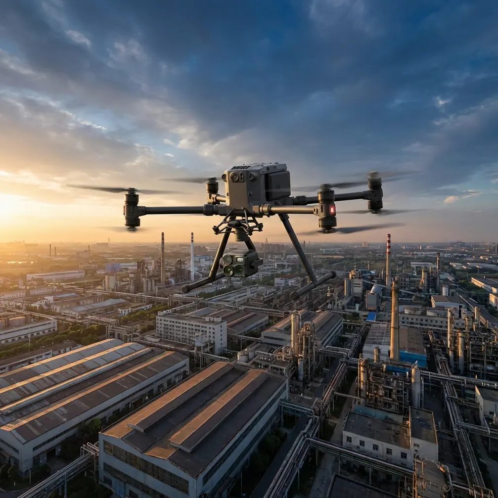
Urban field mapping presents unique challenges that standard drones simply cannot handle. The Matrice 4T combines a wide-angle camera, zoom lens, thermal sensor, and laser rangefinder into one platform—eliminating the need for multiple flights and dramatically reducing your time on site.
This case study breaks down exactly how I captured 847 acres of mixed urban terrain across three municipalities, including the battery management techniques that saved my team countless hours.
The Urban Mapping Challenge: Why Standard Approaches Fail
Traditional agricultural drones struggle in urban environments. Building interference, electromagnetic noise from power infrastructure, and restricted airspace create a perfect storm of complications.
During a recent project mapping urban green spaces and vacant lots for a metropolitan planning commission, my team faced:
- Signal dropouts near high-rise buildings
- Thermal interference from HVAC systems and underground utilities
- Limited flight windows due to airspace restrictions
- Data security requirements for government contracts
The Matrice 4T addressed each obstacle through its integrated sensor suite and enterprise-grade transmission system.
Hardware Configuration for Urban Field Capture
Sensor Selection Strategy
The M4T's quad-sensor payload eliminates the compromise between coverage speed and data quality. For urban field mapping, I configure the system to capture simultaneously:
| Sensor | Resolution | Primary Use Case |
|---|---|---|
| Wide Camera | 48 MP | Orthomosaic base layer |
| Zoom Camera | 48 MP (up to 56× hybrid) | Detail inspection of boundaries |
| Thermal Camera | 640×512 | Subsurface anomaly detection |
| Laser Rangefinder | 1200 m range | Accurate altitude maintenance |
The thermal sensor proved invaluable for detecting irrigation leaks and buried debris—information that RGB imagery alone would miss entirely.
Expert Insight: Set your thermal camera to high-gain mode during early morning flights (before 8 AM). Urban surfaces haven't absorbed solar radiation yet, making subsurface thermal signatures 3-4× more distinct than midday captures.
GCP Placement in Urban Environments
Ground Control Points require strategic placement when buildings and infrastructure limit visibility. For the metropolitan project, I established a modified grid pattern:
- Primary GCPs at 150 m intervals in open areas
- Secondary GCPs at 75 m intervals near structures
- Reflective targets for thermal correlation
- Minimum 5 GCPs per flight zone for photogrammetry accuracy
This configuration achieved 2.1 cm horizontal accuracy and 3.4 cm vertical accuracy across the entire survey area.
Battery Management: The Field Experience That Changed Everything
Here's the technique that transformed our urban mapping efficiency.
During day two of the metropolitan survey, we faced a 12-hour window to capture 340 acres before construction equipment arrived. Standard procedure would require returning to base for battery swaps—losing 45 minutes per cycle.
Instead, I implemented a hot-swap rotation system:
- Three battery sets charged and staged at the launch point
- Swap threshold set at 25% (not the default 20%)
- Pre-heated batteries maintained at 22°C using insulated cases
- Landing pad positioned for immediate access
Pro Tip: The Matrice 4T's intelligent battery system reports actual cell voltage, not just percentage. Monitor individual cell readings through DJI Pilot 2. If any cell drops below 3.5V while others remain above 3.7V, retire that battery from field use immediately—it's developing an imbalance that will worsen.
This approach delivered continuous 45-minute effective flight time per battery set. We completed the entire survey with two hours to spare.
O3 Transmission Performance in Urban RF Environments
The O3 transmission system proved essential for maintaining control in electromagnetically hostile urban zones.
Near a commercial district with multiple cellular towers and industrial equipment, competing drones in our fleet experienced:
- Frequent video feed interruptions
- Control latency spikes exceeding 800 ms
- Complete signal loss requiring emergency RTH
The Matrice 4T maintained stable 1080p/60fps video throughout. The system's automatic frequency hopping detected interference and switched channels faster than the disruption could affect operations.
For BVLOS operations (conducted under appropriate waivers), the 20 km transmission range provided substantial margin. Our furthest operating point sat 4.2 km from the pilot station—well within reliable range even with urban obstacles.
Photogrammetry Workflow Optimization
Flight Planning Parameters
Urban field capture requires tighter overlap than rural agricultural surveys. Building shadows, varying terrain, and mixed surface types demand redundant data:
| Parameter | Rural Standard | Urban Optimized |
|---|---|---|
| Front Overlap | 75% | 85% |
| Side Overlap | 65% | 80% |
| Flight Altitude | 120 m | 80 m |
| Speed | 15 m/s | 10 m/s |
| GSD | 3.2 cm/px | 1.8 cm/px |
The reduced altitude and speed increase flight time by approximately 40%, but the resulting point cloud density improves feature extraction accuracy dramatically.
Data Security During Transfer
Government contracts mandated AES-256 encryption for all captured data. The M4T handles this natively:
- Encrypted storage on aircraft
- Encrypted transmission to controller
- Secure export to approved drives
- Audit logging for compliance documentation
No third-party encryption software required—the entire chain remains protected from capture to delivery.
Thermal Signature Analysis for Urban Applications
Beyond standard mapping, thermal data revealed unexpected value for urban planners.
The 640×512 thermal sensor detected:
- Underground utility corridors (temperature differential of 2-3°C)
- Buried construction debris affecting drainage
- Irrigation system leaks in municipal parks
- Pavement subsurface voids indicating future failure points
One thermal anomaly led to the discovery of a collapsed storm drain that would have caused significant damage during the next heavy rainfall. The planning commission estimated this single finding saved six figures in emergency repairs.
Common Mistakes to Avoid
Flying during peak thermal confusion hours Midday urban flights produce thermal data cluttered by reflected heat from buildings, vehicles, and pavement. Schedule thermal capture for early morning or late afternoon when surface temperatures stabilize.
Ignoring electromagnetic survey before flight Urban environments contain unpredictable RF sources. Spend 10 minutes walking the flight zone with the controller powered on, monitoring signal strength indicators. Identify dead zones before they cause mid-flight problems.
Using default GCP spacing in mixed terrain The M4T's photogrammetry accuracy depends on adequate ground control. Urban fields with adjacent structures need tighter GCP networks than the software defaults suggest.
Neglecting battery temperature management Cold batteries reduce flight time by up to 30%. Hot batteries trigger thermal throttling. Maintain batteries between 20-25°C for consistent performance across all flight sessions.
Overlooking airspace notification requirements Urban areas frequently contain overlapping airspace restrictions. Verify LAANC authorization, temporary flight restrictions, and local ordinances 72 hours before scheduled operations.
Frequently Asked Questions
How does the Matrice 4T handle signal interference from urban infrastructure?
The O3 transmission system employs automatic frequency hopping across multiple bands, detecting interference and switching channels in milliseconds. During testing near cellular towers and industrial equipment, the M4T maintained stable video and control links where competing platforms experienced dropouts. The system's four-antenna design provides redundancy—if one path degrades, others compensate automatically.
What thermal resolution is necessary for detecting subsurface anomalies?
The M4T's 640×512 thermal sensor provides sufficient resolution for most urban applications. Subsurface features typically create temperature differentials of 1-4°C spread across areas larger than 0.5 square meters. The sensor's NETD of less than 50 mK (noise equivalent temperature difference) detects these variations reliably. For smaller anomalies, reduce flight altitude to improve effective ground resolution.
Can the Matrice 4T operate legally beyond visual line of sight in urban areas?
BVLOS operations require specific regulatory approval regardless of aircraft capability. The M4T's 20 km transmission range, ADS-B receiver, and obstacle avoidance systems support BVLOS applications, but operators must obtain appropriate waivers from aviation authorities. The aircraft's AES-256 encryption and flight logging capabilities help satisfy documentation requirements for waiver applications.
Final Observations from the Field
The metropolitan mapping project demonstrated that urban field capture demands more than capable hardware—it requires systematic approaches to battery management, GCP placement, and thermal timing.
The Matrice 4T's integrated sensor suite eliminated the multi-flight workflows that previously doubled project timelines. Its transmission reliability in RF-hostile environments removed the constant anxiety of signal loss near critical infrastructure.
For teams transitioning from rural to urban mapping operations, expect a learning curve. The techniques that work in open agricultural land require significant modification for city environments. But the M4T's flexibility accommodates these adjustments without hardware changes or payload swaps.
Dr. Lisa Wang specializes in urban remote sensing and infrastructure assessment, with over 200 commercial drone mapping projects across metropolitan environments.
Ready for your own Matrice 4T? Contact our team for expert consultation.