Matrice 4T at High Altitude: A Practical Venue Capture
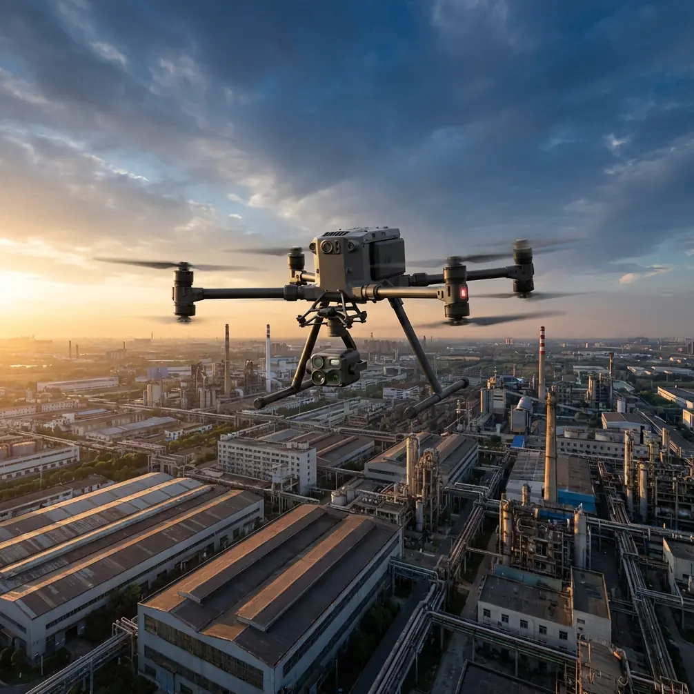
Matrice 4T at High Altitude: A Practical Venue Capture Strategy That Starts on the Ground
META: Expert Matrice 4T advice for high-altitude venue capture, covering ground handling loads, antenna positioning, transmission reliability, thermal workflows, and mapping accuracy.
High-altitude venue capture sounds glamorous until the aircraft is still on the ground and the real problems begin.
Thin air gets most of the attention. It should. But for teams flying a Matrice 4T around mountain resorts, hillside event spaces, alpine campuses, or elevated construction venues, mission failure often starts before takeoff: rough taxi surfaces, awkward staging areas, wind-driven rotor disturbances, inconsistent line-of-sight, and poor control link discipline. Add the pressure of collecting usable thermal data and map-grade visuals in one sortie, and the workflow gets tight very quickly.
I want to frame this from a design-and-operations perspective rather than a feature checklist. Two details from classic aircraft design references are especially useful here, even though they come from crewed aviation and helicopter structural logic rather than a drone manual.
The first is a helicopter ground-load principle: ground operating conditions are not a single event but a family of cases. The reference specifically calls out taxiing, braking, turning, towing, tie-down, lifting, rotor startup, rotor braking, and even gust-driven blade movement. That matters because high-altitude venue teams often obsess over airborne performance and neglect the handling envelope on the ground. The second is a turning-load detail: when determining loads during ground turning, the lateral load factor at the center of gravity is limited by rollover constraints and “need not exceed 0.5.” Operationally, that is a reminder that side loads during uneven or hurried ground maneuvering are not trivial. The airframe may be small compared with a helicopter, but the physics lesson scales down remarkably well: bad ground habits create avoidable risk.
For Matrice 4T crews, this becomes the foundation of a reliable venue capture workflow.
The real problem with high-altitude venue capture
A venue in elevated terrain is rarely a clean open field. More often it is a layered environment: retaining walls, metal roofs, temporary structures, power runs, lift towers, grandstands, trees, and abrupt changes in slope. You may need cinematic overviews for stakeholders, thermal signature analysis for building envelope checks, and photogrammetry outputs for planning or maintenance. The aircraft can do all three classes of work. The challenge is sequencing them without letting environmental variables degrade the data.
High altitude changes battery behavior, climb efficiency, and wind exposure. It also magnifies communication mistakes. I see this constantly: pilots launch from a sheltered low point, tuck themselves beside a vehicle or building for comfort, then wonder why O3 transmission quality drops as soon as the aircraft crosses terrain or rotates behind a structure. The problem was baked in at setup.
That is why antenna positioning deserves more attention than it usually gets.
Antenna placement is not a small detail
If you want maximum range and cleaner signal stability with the Matrice 4T, start with body position and controller orientation before arming the motors.
The practical rule is simple: place yourself at a point where the aircraft’s full mission arc stays as visible as possible, not where takeoff feels convenient. At high-altitude venues, this often means walking 20 to 50 meters to a ridge shoulder, terrace edge, or open service platform with cleaner geometry to the intended flight area. Then align the controller antennas so their broadside faces the aircraft rather than pointing the antenna tips directly at it. Many range complaints are really antenna geometry mistakes mixed with terrain masking.
This matters even more when the mission includes thermal inspection. A thermal signature pass is often slower and more deliberate than a general visual orbit. That means the aircraft may spend more time near structures, rooflines, or terrain folds that interfere with the link. Good antenna discipline gives you margin.
If your venue has stepped elevation, don’t stand at the lowest possible control point unless BVLOS planning, observers, and site safety measures have been specifically built around that geometry. Even in legal and well-managed extended-visibility operations, signal quality is usually strongest when the pilot chooses a control location based on propagation, not convenience.
Why ground-load thinking improves drone missions
The helicopter design reference lists multiple ground load cases because the aircraft experiences meaningful stress before and after flight, not only during it. That mindset is useful for Matrice 4T operators working at mountain venues.
Consider three common mistakes:
Aggressive hand-carry relocation over uneven ground
Teams frequently reposition the aircraft between launch spots without fully stabilizing accessories, payload covers, or landing contact surfaces.Fast surface turns during setup or recovery
On sloped concrete, gravel, or compacted soil, a rushed pivot can introduce side loading and tip risk.Wind exposure during motor start or shutdown
In elevated terrain, gusts can appear from oblique angles and change rapidly near structures.
The reference’s mention of rotor startup, braking, tie-down, lifting, and gust-induced blade movement is not directly about the Matrice 4T’s exact hardware. But the operational significance is clear: treat the ground phase as a structured part of the mission, not dead time. Build a checklist for staging, launch orientation, shutdown orientation, and carrying method. Use a landing pad when surface debris or snowmelt grit is present. If the site requires moving between terraces or rooftops, assign one person to aircraft handling and another to path clearing and visual watch. Small crews tend to skip this. That is where damage begins.
The upward load factor detail from the same source is also revealing. The handbook states that mass items above and behind the cabin—examples given include rotor systems, transmission, and engines—use an upward load factor of 1.5, with other directional factors also defined. You do not need to convert that into a drone structural calculation to appreciate the lesson. Components mounted high or aft in any aircraft architecture deserve respect during transport, lifting, and abrupt motion. For a payload-equipped drone platform, that means avoiding jerky case handling, unstable vehicle storage, and careless deck placement in windy areas. Reliability is cumulative.
A better Matrice 4T workflow for elevated venues
For high-altitude venue capture, I recommend splitting the mission into four phases.
1. Ground survey before aircraft power-up
Walk the site first. Look for:
- magnetic clutter from large steel structures
- narrow terrace edges that could distort GNSS confidence or crew movement
- likely signal shadows behind ridgelines or roofs
- heat-reflective surfaces that can confuse quick thermal interpretations
- candidate GCP locations if photogrammetry accuracy matters
This is where the helicopter-style ground-case mindset pays off. Ask not only “Where can I launch?” but also “Where can I brake the mission safely, where can I recover if wind shifts, and where can I relocate without stressing the aircraft?”
2. Transmission-first setup
The Matrice 4T’s O3 transmission capability is only as good as the line you give it. Elevation can help range, but only if your signal path is not blocked by the venue itself.
My field rule:
- stand high enough to clear the nearest obstruction
- keep antennas broadside to the aircraft
- avoid backing up against metal railings, vehicles, or service housings
- pre-brief a fallback pilot position if the aircraft must work behind a building face
For teams doing repeated venue documentation, save a site diagram with best control positions marked by mission type: visual survey, thermal pass, façade inspection, or mapping run. This makes repeatability far better than relying on memory.
If your operation requires a more formal communications and observer plan, it often helps to review the route in advance with a technical specialist rather than improvising on site. A quick message through our flight planning channel can save a wasted survey day.
3. Sensor sequencing for usable data
The Matrice 4T becomes much more valuable when crews stop mixing objectives randomly.
For venue capture, I like this order:
First pass: broad visual orientation
Establish the geometry of the venue, identify wind corridors, and confirm the safest approach lines near towers, seating structures, or roof edges.
Second pass: thermal signature acquisition
Do this while environmental conditions are still stable enough to produce contrast. Thermal data at high-altitude sites can be excellent for spotting roof moisture patterns, heat loss zones, overloaded utility segments, or uneven mechanical performance. But the thermal pass should be intentional. Slow down. Maintain consistent standoff distance. Avoid changing altitude constantly if you want comparative value between frames.
Third pass: photogrammetry mission
If you need mapping or model generation, move into a disciplined pattern and support it with GCPs where practical. High-altitude venues often have repeating textures—seating rows, stone paving, snow edges, reflective roofs—that can weaken reconstruction confidence. Good GCP placement tightens the final output and reduces ambiguity around elevation steps.
This sequence also helps battery planning. Thermal work and mapping work do not stress the aircraft in the same way operationally, even if they happen on the same platform.
4. Recovery and immediate data check
Do not pack up right after landing. Review:
- thermal contrast consistency
- map overlap sufficiency
- transmission drop points on the route
- timestamps for any interference or wind-induced drift
This is the drone equivalent of respecting post-landing loads and conditions. A rushed shutdown in a gusty, uneven venue environment often leads to missed faults or damaged props during packing.
What the stall-reference material teaches us indirectly
The second source deals with civil aircraft certification language around reference stall speed, approach speed selection, warning onset, and the need to prove acceptable trajectory stability and controllability when encountering wind shear in normal route and takeoff/landing configurations. One line stands out operationally: acceptable handling must be demonstrated through a reasonable combination of simulation and flight testing, including wind-shear encounters.
No, you are not certifying the Matrice 4T under transport-aircraft rules. But the principle transfers well. High-altitude venue operations should not rely on brochure assumptions. They should rely on a mix of simulated route planning and actual field validation.
For example:
- simulate your orbit and mapping lines against terrain before arrival
- estimate where crosswinds will channel between structures
- test one short route segment first rather than committing the full mission
- watch for control feel changes near cliff edges, open bowl-shaped venues, or roof transitions
The reference also distinguishes between defined approach and warning speeds, essentially separating “what the aircraft can do” from “what gives the operator safe margin.” That distinction matters in drone work too. Maximum transmission range, top speed, and nominal endurance are not planning numbers for a high-altitude venue. Margin is the planning number.
Security and continuity matter more on remote sites
Remote venues often involve sensitive layout data, infrastructure imagery, or pre-event planning files. If your Matrice 4T workflow includes client drawings, route templates, or inspection imagery moving between teams, AES-256-secured handling and disciplined file transfer procedures are worth treating as standard practice rather than enterprise extras.
The same goes for power continuity. Hot-swap batteries can be more than a convenience in cold or elevated environments where setup time is expensive and weather windows are short. They reduce downtime between flights and help crews preserve mission rhythm. That matters because venue capture quality often depends on consistency: same lighting trend, same thermal conditions, same wind band, same crew position.
The takeaway for serious Matrice 4T venue work
A strong high-altitude venue mission is rarely won by a single spec. It is won by disciplined setup.
Think like a designer on the ground and an operator in the air. Respect turning loads, surface conditions, braking logic, and wind exposure during launch and recovery. Pick your pilot position for signal propagation, not comfort. Use O3 transmission intelligently with proper antenna orientation. Separate thermal signature collection from photogrammetry logic. Support mapping with GCPs when the site has repetitive or stepped geometry. And build every flight around margin, not marketing numbers.
That is how the Matrice 4T starts behaving less like a flying camera and more like a dependable field instrument.
Ready for your own Matrice 4T? Contact our team for expert consultation.