Filming High-Altitude Fields with the Matrice 4T
Filming High-Altitude Fields with the Matrice 4T: A Specialist Case Study
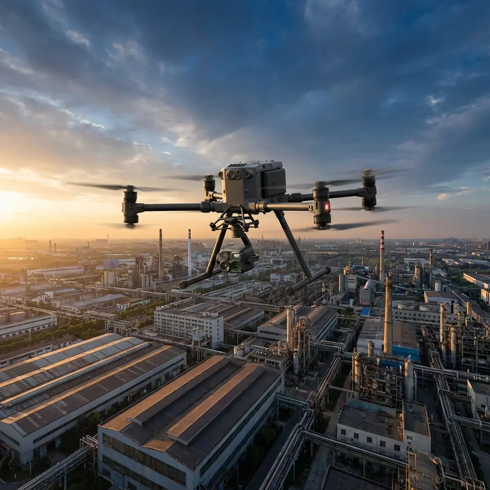
META: A field-based case study on using the DJI Matrice 4T for high-altitude agricultural filming, thermal scouting, stable data capture, and safer long-range operations.
I still remember a mountain farm survey where the aircraft was not the biggest problem. Thin air was. The fields sat high above the valley floor, stepped across uneven terrain, with fast-changing wind and patches of cold shade that confused the eye from ground level. The client wanted more than attractive footage. They needed imagery they could actually use: crop condition evidence, terrain context, and thermal clues from irrigation lines and stressed sections of the field.
That kind of job exposes the gap between “a drone that can fly there” and “a drone system that can return usable results.”
For this case, the Matrice 4T fits the story because it reduces friction at several points that matter in high-altitude agricultural filming: visual capture, thermal interpretation, link reliability, and field continuity. Those are not marketing bullet points when you are standing on a ridge with changing light, low temperatures, and a narrow weather window. They are the difference between repeating sorties and finishing the mission cleanly.
The real problem with high-altitude field filming
When people talk about filming fields, they often imagine broad, easy passes over flat land. Mountain agriculture is the opposite. You deal with elevation changes, mixed reflectivity from soil and vegetation, and perspective distortion that makes it harder to judge plant uniformity. A healthy section can look weak if the sun angle is wrong. A water distribution issue may not be visible at all in standard RGB footage until damage has already spread.
At altitude, another layer appears: battery performance and aircraft handling can become less forgiving. You are often launching from imperfect ground, surrounded by slopes that break line-of-sight and make signal management more than a technical footnote. If the operation also includes photogrammetry, now consistency matters just as much as cinematic quality. Every pass has to support overlap, alignment, and reliable geospatial output.
This is where the Matrice 4T earns attention. Not because it is simply “advanced,” but because its integrated sensing package lets one aircraft support more than one objective in a single field session.
Why the thermal side matters more than most crews expect
The “T” in Matrice 4T matters most in agriculture when visual footage alone stops telling the truth. A thermal signature can reveal irrigation irregularities, drainage problems, plant stress zones, or equipment heat patterns that standard imaging may miss from a distance. In high-altitude environments, where temperature differentials can become sharper between sunlit and shaded terraces, thermal imaging becomes operationally useful rather than optional.
That was one of the turning points in my own field workflow. Years ago, on a cold morning mission in upland farmland, we captured beautiful visible-light footage but missed the early thermal contrast that would have shown which sections were retaining moisture differently. By the time we revisited with another sensor platform, the light had changed and the comparison value dropped. We had cinematic material, but weaker diagnostic insight.
With the Matrice 4T, the workflow becomes tighter. You can document the field visually for stakeholders who need clear contextual imagery, while also gathering thermal data that points to issues beneath the visual surface. That pairing is especially useful for agronomists, irrigation planners, and land managers who do not want separate visits, separate pilots, and separate datasets that are hard to correlate later.
Filming and photogrammetry do not have to compete
One mistake I still see is treating “filming” and “mapping” as two completely separate missions. In reality, many agricultural clients want both. They need footage for communication, reporting, investor updates, or farm management presentations. They also need repeatable data products.
The Matrice 4T supports that blended field logic well. If the mission is planned properly, you can capture targeted visual sequences around access roads, terraces, water features, and crop boundaries, then shift into a structured collection plan for photogrammetry. That matters because high-altitude fields are rarely simple rectangles. They are fragmented, often sloped, and full of edges that challenge reconstruction quality.
In those conditions, GCP strategy becomes critical. Ground control points are not glamorous, but they protect your output from becoming pretty and inaccurate. On upland farmland, relief variation can distort assumptions quickly. A crew using the Matrice 4T for photogrammetry should think carefully about where GCPs are placed across elevation transitions, not just across horizontal spread. The aircraft may capture the scene efficiently, but poor control distribution will still weaken the deliverable.
Operationally, this is where the platform saves time: one system can gather thermal context, visible documentation, and data suitable for mapping-oriented analysis. That reduces setup complexity in remote locations where every extra case, sensor swap, or relaunch costs energy and daylight.
O3 transmission is not a spec-sheet detail in mountain terrain
A reliable video link sounds mundane until you lose confidence in the aircraft behind a ridge line or near a terrace break. In high-altitude field environments, terrain blocks and reflections can interrupt the clean situational awareness pilots rely on for safe, precise work.
This is why O3 transmission deserves practical attention. The value is not abstract bandwidth language. The value is steadier command confidence and clearer image feedback when the landscape itself works against you. On layered farmland, where the aircraft may momentarily transition across varied elevations and visual backgrounds, a robust transmission system helps the operator make better timing decisions for turns, framing, and route corrections.
That has a direct effect on footage quality. It also has a direct effect on mission discipline. When the link feels solid, crews are less likely to rush awkward passes or cut corners on coverage. In survey-style filming, confidence in transmission translates into more consistent overlap, cleaner path execution, and fewer unnecessary repeats.
For organizations thinking about future BVLOS frameworks where local regulations and approvals permit, transmission integrity becomes even more relevant. Not because the aircraft alone authorizes that kind of operation—it does not—but because the communications architecture is part of the broader trust stack for professional missions. In other words, the link matters before, during, and after the actual flight.
AES-256 matters when the field data is commercially sensitive
Agricultural drone work is often treated as harmless by default. That is a mistake. Field imagery can expose operational patterns, crop performance, infrastructure layouts, and land-use conditions that are commercially sensitive. On large farms, research plots, specialty crops, and managed estates, that data is not trivial.
This is where AES-256 enters the conversation in a meaningful way. Strong encryption is not there to sound impressive. It supports safer handling of transmission and workflow security, particularly when a service provider is working for institutional landowners, agronomy consultants, or operations with proprietary cultivation methods.
On one upland project involving trial plots, the client cared less about the cinematic edit than about controlled handling of the captured data. They wanted confidence that field conditions and layout information were not casually exposed in transit or shared carelessly across devices. A platform that incorporates AES-256 helps answer that concern with something concrete.
For commercial drone teams, trust is built as much through data discipline as through flying skill.
Hot-swap batteries change the pace of mountain operations
Few details are more underrated in the field than battery workflow. In high-altitude environments, launch sites are often inconvenient. You may be operating from a rough farm road, a small staging area, or a narrow terrace edge with limited room for reorganizing equipment. Every interruption can feel larger than it would on flat open ground.
Hot-swap batteries matter because they cut dead time between sorties. If your target is a mix of thermal passes, visual obliques, and photogrammetric lines, continuity matters. You want to preserve the rhythm of the mission while light and wind stay within your usable window. You also want to reduce the chance of small procedural delays snowballing into missed coverage.
That was one of the clearest practical upgrades in our own workflow. Older setups often forced us into awkward pauses that broke concentration and changed the environmental conditions mid-mission. With a hot-swap-capable workflow, the Matrice 4T is better aligned with real farm operations, where the goal is not just to fly safely but to maintain capture consistency from one sortie to the next.
At altitude, where colder temperatures can affect battery behavior, efficient rotation and disciplined power management become even more valuable.
A better way to structure the mission
For readers planning similar jobs, the best results usually come from dividing the operation into three phases.
First, establish context. Start with visible-light passes that define field boundaries, elevation changes, access routes, and key infrastructure such as tanks, channels, or pump points. This gives the client narrative clarity and gives your team orientation for the rest of the mission.
Second, collect thermal intelligence. Use the cooler part of the operational window when thermal contrast is meaningful. Look for irregular signatures across irrigation paths, terraces, and suspect vegetation blocks. In mountain fields, thermal differences can appear patchy because of slope aspect and sun exposure, so interpret patterns in relation to terrain rather than in isolation.
Third, run the mapping logic. If photogrammetry is required, switch from exploratory flying to a disciplined route with overlap, altitude consistency, and well-planned GCP support. The point here is to leave with data that can support real analysis, not just a visually impressive archive.
That sequence works well with the Matrice 4T because the aircraft is not forcing you into a single-purpose flight profile.
What changed for my team after adopting this approach
The biggest improvement was not image quality alone. It was decision quality.
Before using a platform built for both visual and thermal field capture, we often had to make compromises. Do we prioritize the footage the landowner can understand immediately, or the sensor output the agronomist actually needs? Do we remobilize for mapping, or accept weaker spatial structure from a general filming flight? Do we spend time changing setups while weather shifts?
The Matrice 4T narrowed those trade-offs.
It gave us a way to collect richer evidence in a single field visit, especially in places where altitude and terrain make return trips expensive in time and coordination. Thermal signature review became part of the same operational conversation as RGB framing. Photogrammetry planning became less of a separate department and more of an extension of the same mission architecture. O3 transmission improved confidence on difficult terrain. AES-256 helped with data handling assurance. Hot-swap batteries kept the tempo steady when the mountain environment was trying to slow everything down.
That combination matters because clients do not buy flight minutes. They buy clarity.
Final field note for crews considering the Matrice 4T
If your work involves high-altitude agriculture, the Matrice 4T is strongest when you stop thinking of it as a camera drone with a thermal add-on. It is more useful as a field documentation platform that can bridge observation, analysis, and repeatable capture.
That means planning for terrain, not just distance. It means using thermal data to answer a real field question, not just to create interesting overlays. It means respecting GCP placement if photogrammetry is part of the deliverable. And it means treating transmission and encryption as operational tools, not background specs.
If you are working through a mountain farm filming plan and want to compare mission setups, battery rotation strategy, or thermal capture timing, you can message our field team here.
The best drone operations in agriculture are rarely the ones with the most dramatic footage. They are the ones that help the landowner see something earlier, measure something more accurately, or avoid returning to the same ridge twice.
Ready for your own Matrice 4T? Contact our team for expert consultation.