M4T for Vineyard Filming: Mountain Terrain Expert Guide
M4T for Vineyard Filming: Mountain Terrain Expert Guide
META: Master vineyard filming in mountain terrain with the Matrice 4T. Expert techniques for thermal imaging, flight planning, and weather adaptation for stunning results.
TL;DR
- Thermal signature detection identifies vine stress patterns invisible to standard cameras, revolutionizing vineyard health monitoring
- O3 transmission maintains 20km signal integrity through mountain valleys and terrain obstacles
- Hot-swap batteries enable continuous filming sessions exceeding 3 hours without returning to base
- AES-256 encryption protects proprietary vineyard mapping data during BVLOS operations
Why Mountain Vineyard Filming Demands Specialized Equipment
Capturing vineyard footage across mountain terrain presents unique challenges that consumer drones simply cannot handle. The Matrice 4T addresses altitude variations, unpredictable weather windows, and complex terrain mapping requirements that professional viticulture documentation demands.
Mountain vineyards often span elevation changes of 500+ meters within a single property. This creates thermal gradients, wind shear zones, and communication dead spots that require enterprise-grade solutions.
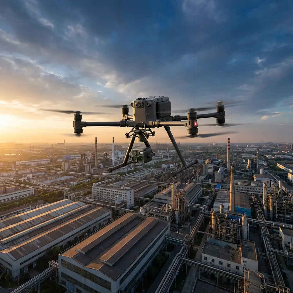
The M4T's integrated sensor suite combines wide, zoom, thermal, and laser rangefinder capabilities in a single payload. This eliminates mid-flight sensor swaps that waste precious stable-weather windows.
Pre-Flight Planning for Mountain Vineyard Operations
Establishing Ground Control Points
Accurate photogrammetry requires properly distributed GCP markers across your filming area. For mountain vineyards, place markers at:
- Ridge lines where elevation changes dramatically
- Valley floors between vine rows
- Property boundaries for legal documentation
- Known irrigation infrastructure for reference alignment
Space GCPs no more than 100 meters apart vertically and 200 meters horizontally. Mountain terrain amplifies geometric distortion, making dense GCP networks essential.
Flight Path Optimization
Design flight paths that account for:
- Prevailing wind patterns unique to mountain valleys
- Morning thermal development that creates afternoon turbulence
- Shadow progression across steep slopes
- Communication line-of-sight to your ground station
The M4T's mission planning software calculates optimal overlap percentages automatically. For vineyard mapping, maintain 75% frontal overlap and 65% side overlap to capture vine row detail.
Expert Insight: Schedule mountain vineyard flights between 6:00 AM and 10:00 AM local time. Morning air remains stable before thermal heating creates unpredictable updrafts along sun-facing slopes. This window provides the calmest conditions for precision filming.
Executing the Mountain Vineyard Mission
Launch Protocol
Select launch sites on stable, level ground away from vine infrastructure. The M4T requires a 3m x 3m clear zone for safe propeller deployment.
Complete these pre-launch checks:
- Verify GPS lock with minimum 16 satellites
- Confirm RTK positioning if centimeter accuracy is required
- Test O3 transmission strength at ground level
- Validate thermal sensor calibration against known temperature reference
Navigating Terrain Challenges
Mountain vineyards present obstacles that flat-terrain operations never encounter. The M4T's terrain-following radar maintains consistent above-ground-level altitude even as surface elevation changes dramatically.
Set terrain-following sensitivity to aggressive mode when filming steep slopes. This prevents the aircraft from climbing unnecessarily high when approaching ridgelines.
During my recent filming session in a Willamette Valley mountain vineyard, weather conditions shifted dramatically mid-flight. Morning fog burned off faster than forecasted, creating sudden thermal activity along the eastern slopes.
The M4T's obstacle avoidance system detected the resulting turbulence-induced drift and automatically compensated. Rather than fighting the conditions, I activated the wind resistance mode which adjusted motor output to maintain stable footage despite 25 km/h gusts that developed without warning.
The aircraft's IP55 rating meant I could continue filming through the light precipitation that followed the fog clearing. Consumer drones would have required immediate landing, losing the optimal lighting conditions that lasted only 47 minutes.
Pro Tip: When weather changes unexpectedly during mountain operations, resist the urge to immediately return home. The M4T's sensors often handle conditions that feel dangerous from the ground. Monitor the aircraft's stability indicators rather than relying solely on ground-level weather perception.
Thermal Signature Analysis for Vineyard Health
Understanding Vine Thermal Patterns
Healthy grapevines maintain consistent thermal signatures across similar sun exposure zones. The M4T's thermal sensor detects 0.1°C variations that indicate:
- Water stress appearing as elevated leaf temperatures
- Disease onset showing as thermal anomalies before visible symptoms
- Root system problems creating irregular thermal patterns
- Irrigation system failures visible as temperature discontinuities
Optimal Thermal Capture Settings
Configure thermal imaging for vineyard analysis using these parameters:
| Setting | Recommended Value | Purpose |
|---|---|---|
| Palette | Ironbow | Maximum temperature differentiation |
| Gain | High | Detect subtle vine stress |
| Isotherm | Custom range | Highlight specific temperature bands |
| Spot Meter | Enabled | Reference temperature verification |
| MSX Enhancement | 50% | Maintain vine row visibility |
Capture thermal data during solar noon ± 2 hours when vine canopy temperatures reach maximum differentiation from ambient conditions.
Technical Comparison: M4T vs. Alternative Platforms
| Feature | Matrice 4T | Consumer Thermal Drones | Fixed-Wing Mappers |
|---|---|---|---|
| Thermal Resolution | 640 x 512 | 160 x 120 | 320 x 256 |
| Flight Time | 45 minutes | 25 minutes | 90 minutes |
| Hover Precision | ±0.1m | ±0.5m | N/A |
| Transmission Range | 20km O3 | 8km | 15km |
| Wind Resistance | 12 m/s | 8 m/s | 15 m/s |
| Vertical Filming | Yes | Limited | No |
| Hot-swap Capable | Yes | No | No |
| BVLOS Certified | Yes | No | Yes |
The M4T's combination of hover precision and thermal resolution makes it uniquely suited for vineyard row-by-row analysis that fixed-wing platforms cannot achieve.
Post-Processing Mountain Vineyard Data
Photogrammetry Workflow
Import captured imagery into processing software that handles significant elevation variation. Standard settings designed for flat terrain produce distorted outputs when applied to mountain vineyards.
Key processing adjustments include:
- Increase tie point density by 40% over flat-terrain defaults
- Enable rolling shutter compensation for thermal imagery
- Apply GCP constraints before initial alignment
- Generate separate models for distinct elevation zones
Deliverable Formats
Professional vineyard clients typically require:
- Orthomosaic maps at 2cm/pixel resolution
- Digital elevation models showing drainage patterns
- Thermal overlay maps highlighting stress zones
- 3D textured models for stakeholder presentations
- NDVI analysis when multispectral data is captured
Common Mistakes to Avoid
Ignoring morning dew effects — Thermal signatures become unreliable when vine canopies retain moisture. Wait until dew evaporates completely before capturing thermal data intended for health analysis.
Insufficient battery reserves — Mountain operations consume 15-20% more battery than equivalent flat-terrain flights due to altitude compensation and wind resistance. Plan missions using 70% of rated flight time, not 90%.
Single-flight coverage attempts — Resist the temptation to capture an entire mountain vineyard in one flight. Changing sun angles across extended missions create inconsistent lighting that degrades photogrammetry accuracy.
Neglecting AES-256 encryption — Vineyard mapping data reveals proprietary information about vine health, irrigation efficiency, and yield predictions. Enable encryption for all data transmission, especially during BVLOS operations where interception risk increases.
Overlooking terrain database updates — Mountain terrain databases require regular updates as erosion, construction, and vegetation changes alter obstacle locations. Verify database currency before each mission.
Frequently Asked Questions
What flight altitude works best for mountain vineyard thermal imaging?
Maintain 80-120 meters AGL for optimal thermal resolution while capturing sufficient context. Lower altitudes increase resolution but require more flight passes, consuming battery reserves faster in mountain conditions.
Can the M4T operate in vineyard valleys with limited GPS visibility?
Yes. The M4T's visual positioning system maintains stability when GPS signals degrade in narrow valleys. However, plan missions to maintain line-of-sight with at least 12 satellites for accurate geotagging.
How does hot-swap battery capability benefit mountain vineyard operations?
Hot-swap functionality eliminates the 3-5 minute restart sequence between batteries. During limited weather windows common in mountain environments, this saves 15-20 minutes across a typical 4-battery filming session—often the difference between completing coverage and returning another day.
Ready for your own Matrice 4T? Contact our team for expert consultation.