Matrice 4T for Urban Highway Mapping: Why Camera Trigger
Matrice 4T for Urban Highway Mapping: Why Camera Trigger Logic Matters More Than Most Teams Realize
META: Expert look at using the Matrice 4T for urban highway mapping, with practical guidance on camera trigger control, ROI setup, grid planning, and pre-flight safety discipline.
Urban highway mapping looks straightforward until you actually try to do it at production quality.
Long linear corridors. Repetitive surfaces. Overpasses. Lane markings that need to stay crisp. Heat shimmer off asphalt. Traffic management constraints. Limited launch zones. And in many city environments, you do not get many chances to fly the same stretch twice without introducing different lighting, traffic, or access conditions.
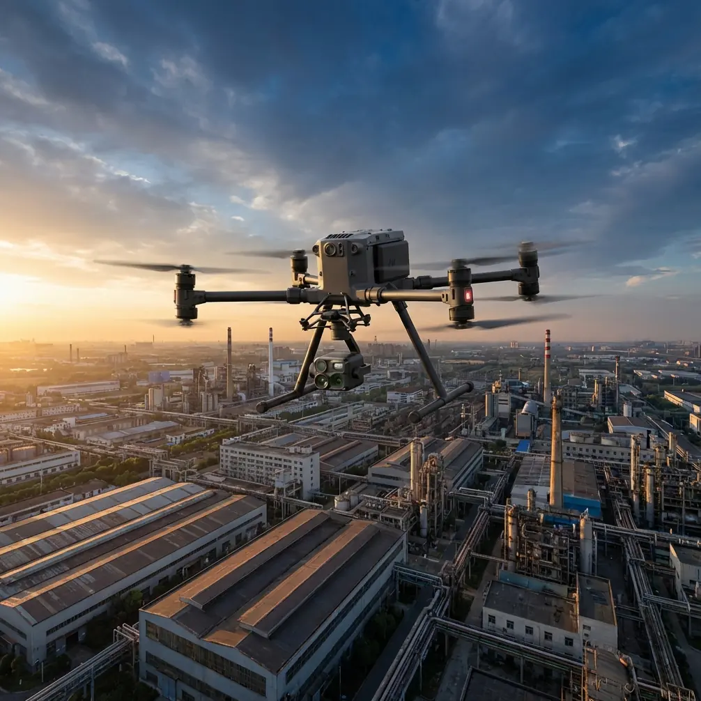
That is why the Matrice 4T deserves a more technical discussion than the usual platform summary. For highway work in dense urban conditions, the airframe matters, of course. Transmission reliability matters. Sensor alignment matters. Battery workflow matters. But one issue quietly determines whether your deliverables are clean or compromised: how the camera is instructed to capture images during the mission.
This is where mission logic from the reference material becomes highly relevant. Two commands stand out: DO_SET_CAM_TRIGG_DIST, which triggers the shutter at fixed distance intervals, and DO_DIGICAM_CONTROL, which fires a single image on command. On paper, that sounds like a minor operational detail. In practice, it shapes the entire difference between repeatable corridor photogrammetry and a messy photo set full of irregular overlaps.
For a Matrice 4T team mapping highways in urban areas, that distinction is not academic. It affects reconstruction quality, field efficiency, and whether the data can support engineering, progress tracking, drainage review, or thermal anomaly checks on adjacent infrastructure.
The real problem: urban highway corridors punish inconsistent capture logic
A highway is not an open agricultural block. It is a constrained corridor with geometry that keeps changing.
One section may be a straight arterial with service roads on both sides. The next might pass under signage gantries, over a rail crossing, beside reflective towers, or around a multilayer interchange. If the image capture pattern is inconsistent, the resulting overlap can drift just enough to create headaches in processing. That usually shows up later as weak tie points, uneven model quality around bridges, or patchy surface reconstruction where the team needed clean deliverables most.
A lot of operators talk about resolution first. I usually start somewhere else: trigger discipline.
The source document describes DO_SET_CAM_TRIGG_DIST as a periodic shutter trigger based on distance, specifically suited for area capture. That is operationally significant because distance-based triggering is generally more stable for mapping than ad hoc manual capture. Instead of relying on the pilot to decide when each image should be taken, the mission tells the camera to fire at measured spatial intervals along the flight path.
For urban highway work, that matters because the aircraft’s ground speed may vary as it adjusts for turns, wind, obstacle constraints, or geofenced routing. If the mission only depends on manual captures or loosely timed intervals, overlap can become uneven. Distance-triggered captures help maintain image spacing even when flight conditions are less than perfect.
The document also identifies Survey (Grid) as a mission mode that automatically generates photo waypoints from a polygon area, then uses DO_SET_CAM_TRIGG_DIST to capture images along the route. That matters more than it first appears. Although highways are corridors rather than broad blocks, many urban segments still benefit from polygon-based planning around interchanges, bridge decks, tolling zones, staging areas, and widened sections where a simple straight corridor pattern misses context. A team that understands when to use grid-style automation and when to rely on corridor-specific adaptations is usually the team that brings back usable data the first time.
Why this pairs well with the Matrice 4T
The Matrice 4T enters this conversation as a practical urban platform because highway mapping increasingly asks one aircraft to do more than one job in a single deployment.
A corridor mission may begin with standard photogrammetry for roadway surfaces and site context. Then the client wants a thermal look at expansion joints, drainage outfalls, utility cabinets, or suspected moisture intrusion around structures. They may also need visual documentation around barriers, retaining walls, or elevated assets. A platform that can support both standard imaging and thermal signature review reduces the need to split work across separate crews.
That flexibility only pays off if the mission structure is equally disciplined.
For photogrammetry, consistency rules. For thermal review, target-specific framing often rules. The reference material effectively maps to both needs. DO_SET_CAM_TRIGG_DIST is your structured capture backbone. DO_DIGICAM_CONTROL is your precision tool when a single, deliberate frame is more useful than a repeating sequence.
Think about a common urban highway scenario. You have a longer mapping leg where you want regular image overlap for processing. Mid-mission, you also need a precise still of a bridge bearing area, a drainage outlet, or a rooftop HVAC unit affected by roadway heat patterns nearby. That is where one-off shutter logic has value. The source text defines DO_DIGICAM_CONTROL as a command that triggers one image immediately. Operationally, this gives the mission designer a way to mix systematic mapping with targeted inspection moments instead of forcing everything into one capture method.
That is a better fit for real fieldwork than pretending every highway job is pure orthomosaic production.
The overlooked setup: gimbal and ROI commands are not optional extras
Another detail in the source material deserves more attention than it usually gets: camera pointing.
The document lists DO_SET_ROI, which directs the camera toward a specific region of interest with defined location and height, and DO_MOUNT_CONTROL, which sets gimbal roll, pitch, and yaw. Those are not side notes. In urban highway mapping, they are often the difference between “we covered the site” and “we covered the site correctly.”
When teams work near elevated ramps, retaining walls, facades adjacent to carriageways, or vertical transport infrastructure, default nadir assumptions can leave blind spots. Using ROI logic allows the camera to maintain attention on a critical asset while the aircraft follows the safer or more legally practical flight path. With the Matrice 4T, that can be particularly useful when combining visual documentation with thermal signature checks on civil structures that are not best captured straight down.
If you need the camera to keep a bridge joint, noise barrier section, or utility interface centered while maintaining standoff, ROI-based tasking is cleaner than repeated manual gimbal corrections. It also reduces pilot workload, which is a serious advantage in city airspace where attention needs to stay available for situational awareness.
And yes, this is where pre-flight discipline matters.
The pre-flight cleaning step most crews rush
Before any urban highway mission, I want one simple thing done properly: clean the safety and imaging surfaces before power-up and again before takeoff.
Not casually. Properly.
The Matrice 4T may be built for serious operations, but urban highway environments are dirty. Fine dust from road shoulders, diesel residue, moisture film, construction debris, and airborne grime can affect obstacle sensing windows, camera glass, and thermal performance. A smudged lens does not always look disastrous on the controller screen. Later, in processing, it can mean reduced clarity on lane markings or subtle thermal inconsistencies where you needed confidence.
This is not housekeeping. It is risk control.
If the mission uses automated capture logic like fixed-distance shutter triggering, the aircraft may collect a large number of images before anyone notices a contamination issue. One dirty optical surface can scale into an entire compromised data set. So the sequence should be simple: clean vision and camera surfaces, verify gimbal freedom, confirm no residue remains, then validate mission parameters.
That one habit saves more reflight hours than most software tweaks.
Problem-solving with mission design: grid logic, corridor reality
The source document references Survey (Grid) and even mentions Survey (Gridv2) as under development, plus SimpleGrid, which creates a grid area without automatic camera functions. For highway teams, that tells us something useful: mission planning tools distinguish between geometry generation and camera automation, and you should too.
A polygon grid is not automatically a good highway mission.
In urban work, the best result often comes from dividing the job into logical segments:
- narrow corridor runs for the main roadway
- polygon grids for interchanges and widened nodes
- targeted ROI tasks for vertical or off-axis structures
- single-shot captures for exceptions and documentation
That structure mirrors how real infrastructure behaves. It also creates cleaner photo sets for downstream processing.
If your deliverable includes photogrammetry, GCP strategy should follow the same segmentation logic. Urban highways can introduce GNSS challenges from surrounding buildings, sign structures, and reflective surfaces. Strong ground control placement around transitions, merges, and elevation changes helps stabilize reconstruction where flight geometry becomes more complex. The aircraft can collect excellent imagery, but the mapping outcome still depends on field control and mission design being aligned.
Why transmission and data security still belong in the conversation
Even when the heart of the mission is camera logic, the broader platform stack matters. In city environments, reliable transmission is not a luxury. It is operational breathing room. O3-class transmission performance helps maintain control confidence around urban clutter and signal-rich environments, especially when the route includes alternating open and constrained sections.
Data handling matters too. Highway projects often involve sensitive infrastructure records, construction staging details, or as-built conditions not meant for casual circulation. If your workflows involve protected links and encrypted handling such as AES-256-class security, that is not marketing fluff. It is part of professional infrastructure practice.
I would not pretend transmission and encryption are the whole story. They are not. But once the mission design is solid, they become part of what makes the operation dependable enough for repeat client work.
Battery workflow affects mapping quality more than teams admit
Hot-swap batteries sound like an efficiency feature. In reality, they influence data continuity.
Urban highway flights are frequently interrupted by access restrictions, traffic windows, or limited launch locations. If the crew can swap power quickly and resume with minimal downtime, the data set is more likely to stay consistent in light and environmental conditions. That consistency matters for photogrammetry and also for thermal interpretation, where changing pavement temperature or shadow movement can alter what the images appear to show.
The point is not speed for its own sake. The point is preserving comparability across segments of the same mission.
A practical approach for Matrice 4T highway teams
If I were structuring a Matrice 4T urban highway mission around the reference material, the logic would be straightforward:
Start with a route design that separates corridor mapping from complex nodes. Use fixed-distance triggering where overlap consistency is essential. Introduce one-shot capture commands only where a specific asset or event needs a discrete image. Use ROI and gimbal orientation intentionally for vertical or offset structures. Clean optical and sensing surfaces before flight so the automation does not scale a preventable error. Then support the whole mission with sound GCP placement, stable transmission practice, and disciplined battery turnover.
That is not flashy. It is what works.
And for crews building out repeatable highway workflows, that structure usually produces better outputs than trying to force every task into one generic automated pattern.
If your team is refining this kind of mission architecture for urban roadway projects, it can help to compare planning assumptions before the next field day. A quick way to do that is to message a Matrice 4T workflow specialist on WhatsApp.
What the reference material really tells us
The source is brief, but it contains a valuable lesson. It does not talk in broad promises. It points to the mechanics that shape mission outcomes:
- DO_SET_CAM_TRIGG_DIST for periodic distance-based image capture
- DO_DIGICAM_CONTROL for a single shutter event
- DO_SET_ROI to keep the camera aimed at a defined point of interest
- DO_MOUNT_CONTROL to explicitly manage roll, pitch, and yaw
- Survey (Grid) built around a polygon and automated photo capture
Those are small building blocks. In urban highway mapping, they become a system.
For the Matrice 4T, that system is what turns a capable drone into a reliable infrastructure tool. Not because the aircraft is doing something magical, but because the mission logic matches the job. Highways reward precision. City conditions punish improvisation. The teams that understand the difference usually deliver cleaner maps, better inspection context, and fewer surprises in processing.
Ready for your own Matrice 4T? Contact our team for expert consultation.