Matrice 4T in Steep Vineyards: A Field-Driven Case Study
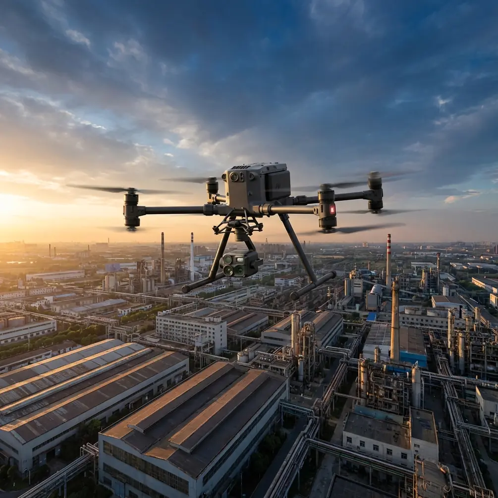
Matrice 4T in Steep Vineyards: A Field-Driven Case Study on Stability, Control, and Reliable Mapping
META: A practical Matrice 4T case study for vineyard mapping in complex terrain, covering stability logic, control continuity, photogrammetry workflow, thermal insight, and why disciplined setup matters on steep ground.
When people talk about vineyard mapping, they often flatten the problem into a neat grid. Real vineyards are rarely that polite.
Terraced blocks, changing row direction, narrow access lanes, cut slopes, heat pockets, and uneven canopy vigor all push a drone system beyond brochure-level performance. In hilly wine regions, the aircraft is not just capturing imagery. It is constantly negotiating transitions: between hover and forward movement, between cool gullies and sunlit ridgelines, between clean GNSS exposure and partial obstruction near tree lines or infrastructure. That is exactly where the Matrice 4T becomes interesting.
This article is built around a practical scenario: mapping vineyards in complex terrain where photogrammetry, thermal signature analysis, and repeatable flight behavior all matter. And rather than treating the Matrice 4T as a generic enterprise drone, I want to focus on something more specific: why control discipline and stability logic matter so much in these jobs, and how a few overlooked engineering principles help explain where this platform stands out.
The vineyard problem is not just image capture
A vineyard manager may ask for an orthomosaic. The agronomist may want temperature differentials across blocks. The operations team may need to verify drainage patterns, access roads, and missing vines after weather events. Those are different outputs, but they share a common operational demand: the aircraft must remain predictable while the environment changes fast.
In complex terrain, mapping quality does not fail only because of camera limitations. It also fails when flight behavior becomes inconsistent. A small shift in yaw hold, a less smooth transition into a turn along a contour, or a momentary instability during a low-speed pass can ripple through the entire dataset. GCP placement helps anchor the final model, but stable acquisition is what gives the software something trustworthy to work with in the first place.
That is where a useful comparison emerges. Some competing platforms can produce acceptable vineyard maps in straightforward fields, yet start to feel less composed when the mission demands repeated low-altitude passes, thermal checks between blocks, and careful repositioning over sloped terrain in changing wind. The Matrice 4T tends to earn its reputation not because one single spec overwhelms the field, but because the whole system behaves like a working tool rather than a nervous camera carrier.
A lesson from control systems that still applies in modern UAV work
One of the more revealing reference details comes from a radio-control gyro manual, which describes the ability to switch between Normal mode and AVCS mode, while also allowing three different rate settings and even simultaneous control across three axes. On paper, that looks like model-aircraft configuration trivia. In practice, it points to a principle every serious vineyard operator should respect: stability is not one-dimensional.
Why does this matter for a Matrice 4T mission? Because on steep vineyard terrain, the aircraft is not simply holding position. It is continually balancing directional discipline, attitude correction, and smooth response to pilot or mission commands. The manual’s distinction between standard response behavior and heading-lock style stabilization is operationally significant. It reminds us that not all “stability” is the same. There is a difference between an aircraft that merely damps motion and one that maintains directional intent through disturbance.
For vineyard mapping, that distinction shows up during cross-slope tracking. If you are flying a row edge in shifting wind, the aircraft needs more than a basic correction loop. It needs composure. Stable yaw behavior preserves image overlap consistency. Predictable axis control reduces smear and heading drift. When thermal data is being layered against visual and mapped outputs, that consistency becomes even more important, because interpretation depends on clean correlation between flight path, surface condition, and captured thermal pattern.
The old reference also notes that the initial setup may not define the sensitivity channel by default. That is a small detail with a big modern echo. Enterprise crews sometimes assume advanced aircraft will compensate for sloppy preparation. They won’t. On a Matrice 4T vineyard job, pre-mission discipline still matters: mission profile review, payload settings, overlap planning, terrain awareness, battery strategy, and control checks. Good data starts before takeoff.
Smooth transitions are what separate usable maps from patchwork
The second source, a design handbook on aircraft ground steering systems, seems unrelated at first glance. It deals with nosewheel steering, response characteristics, and the need for smooth transition from one control regime to another. But the engineering logic is deeply relevant to drone operations.
One passage emphasizes that during takeoff and landing, steering response must transition smoothly and continuously from wheel-based directional control to aerodynamic control. That sentence belongs to conventional aircraft design, yet the underlying principle transfers beautifully to vineyard drone work: control handoff and response continuity matter.
On a Matrice 4T mission in terraced vineyards, you are constantly moving through mini-transitions. Manual repositioning to automated waypoint capture. Hover to low-speed lateral movement. Visual inspection mode to photogrammetry pass. Thermal review over stressed blocks, then precise return to a planned route. If those transitions are abrupt or inconsistent, mission quality suffers. Not always dramatically. Sometimes it shows up as subtle stitching errors, uneven overlap, or the need to re-fly segments that should have been captured correctly the first time.
The same handbook includes another excellent design insight: static deflection is not the only condition that determines required output torque. In some cases, dynamic turning, asymmetric braking, or minimum-radius turns create larger demands than the obvious stationary case. Again, different aircraft category, same operational truth. For vineyard drones, the most demanding moment is not always a steady hover over a row. It can be the dynamic correction during a contour turn near a slope break, or the short repositioning move where terrain, wind, and camera task all converge.
This is one reason the Matrice 4T feels more suitable for serious agricultural terrain work than lighter, less integrated alternatives. It is not simply that it can fly the mission. It is that it remains useful during the awkward moments that usually expose weaknesses.
Case study: mapping a hillside vineyard after uneven irrigation performance
Let’s make this concrete.
A vineyard operator wants a full block review after several weeks of uneven irrigation distribution on sloped ground. The site includes terraces, mixed row orientations, and pockets where morning shade delays drying. The brief is not limited to a pretty map. They need:
- a photogrammetric base layer for row-level reference
- thermal signature review to identify possible water stress patterns
- comparison zones tied to GCP-backed spatial accuracy
- a repeatable workflow that can be flown again in similar light and weather conditions
This is where the Matrice 4T workflow starts to make sense.
The mission begins with a GCP plan that accounts for elevation change rather than treating the site like flat farmland. Ground control points are distributed to support both horizontal and vertical consistency across terraces. The aircraft is then used to collect visible-spectrum mapping data with enough overlap to maintain strong reconstruction through changing relief. After that, thermal passes focus on suspect blocks where canopy temperature divergence may indicate irrigation or root-zone issues.
The value is not just the thermal camera itself. It is the combination of stable acquisition, reliable transmission, and practical field endurance. O3 transmission matters in this environment because vineyard sites often create awkward signal geometry around ridges, service roads, and vegetation boundaries. AES-256 matters too, especially for commercial growers and consultants handling sensitive operational data such as yield zones, infrastructure layouts, and treatment planning. These are not decorative features. They affect whether a drone can be used confidently inside a professional workflow.
Hot-swap batteries also become more than a convenience on terrain-heavy agricultural missions. In flatter sites, battery changes are mostly a pacing issue. In vineyards spread across slopes and separate blocks, they are a continuity issue. If a crew can rotate batteries without dragging the whole workflow into a long reset, they preserve timing, light conditions, and thermal comparability. That directly improves the value of repeat surveys.
Why thermal signature interpretation benefits from stable flight behavior
Thermal work in vineyards is easy to misunderstand. Operators sometimes expect thermal images to give instant agronomic truth. They do not. Thermal data is contextual. A warmer canopy can suggest stress, but also row orientation effects, transient sun exposure, or local airflow differences.
That is why stability and repeatability matter so much.
If the aircraft’s heading, speed, or altitude varies more than it should during thermal capture, interpretation becomes harder. You are no longer comparing like with like. The Matrice 4T helps here because it can support a more disciplined, repeatable collection pattern across difficult terrain. That allows the analyst to ask better questions: Is this heat signature persistent across the row block? Does it align with known irrigation zones? Does the anomaly remain visible when checked against the photogrammetry layer and field notes?
Competitors often advertise thermal capability as if the sensor alone is the differentiator. In operational vineyard work, it isn’t. The real differentiator is whether the platform gives you thermal data that still holds up after georeferencing, review, and repeat inspection.
BVLOS conversations should start with workflow maturity, not bravado
Some larger vineyard operations are already thinking about BVLOS for multi-block monitoring or contractor-led regional coverage. That can make sense in the right regulatory framework, but the conversation should begin with workflow maturity rather than ambition.
A Matrice 4T can fit into that progression because it supports the habits that BVLOS planning demands: repeatability, secure transmission, disciplined battery management, and clear mission segmentation. Even when flights remain within standard visual frameworks, those same habits improve outcomes. Teams that build precise line-of-sight procedures usually generate better data than teams chasing advanced approvals before mastering the basics.
If you are evaluating whether your site and workflow are suitable for more advanced vineyard survey planning, it helps to talk to someone who understands both the aircraft and the terrain realities. For that, you can message a field specialist directly.
Where the Matrice 4T genuinely excels
The Matrice 4T’s advantage in complex vineyards is not that it replaces agronomy expertise or survey discipline. It doesn’t. Its advantage is that it reduces the number of weak links between mission intent and useful output.
Here is the practical summary.
First, it supports mixed-use missions better than many simpler aircraft. You can move from visual inspection to thermal review to structured mapping without feeling like the platform was built for only one of those jobs.
Second, its operational stability matters more on sloped agricultural land than many buyers initially realize. The reference material on gyro rate switching and axis control may come from a different aviation context, but the lesson is universal: controllable stability across changing conditions is what preserves mission quality. In vineyards, that translates directly into better overlap, cleaner thermal interpretation, and fewer compromised passes.
Third, the aircraft fits professional workflows where data integrity matters. O3 transmission, AES-256 security, and hot-swap battery support are not abstract enterprise features. They solve real field problems.
And fourth, it performs especially well where competitors often start to show strain: dynamic terrain, repeated transitions, and missions that combine inspection with geospatial deliverables.
Final thought from the field
The best vineyard drone maps are usually not the product of the most dramatic flight. They come from quiet competence. Stable lines. Thoughtful GCP placement. Repeatable thermal collection. Clean transitions between tasks. A system that behaves predictably while the terrain does not.
That is why the Matrice 4T deserves serious attention for vineyard mapping in complex terrain. Not because it promises magic, but because it handles the operational subtleties that real agricultural work keeps throwing at it.
Ready for your own Matrice 4T? Contact our team for expert consultation.