M4T for Construction Site Monitoring: Expert Terrain Guide
M4T for Construction Site Monitoring: Expert Terrain Guide
META: Master Matrice 4T construction monitoring in complex terrain. Expert antenna positioning, thermal workflows, and BVLOS strategies for site managers.
TL;DR
- O3 transmission maintains stable video feeds across rugged construction terrain with proper antenna positioning
- Thermal signature detection identifies equipment heat anomalies and worker safety zones in real-time
- Hot-swap batteries enable continuous monitoring sessions exceeding 4 hours with minimal downtime
- Strategic GCP placement combined with photogrammetry workflows delivers 2cm accuracy for progress tracking
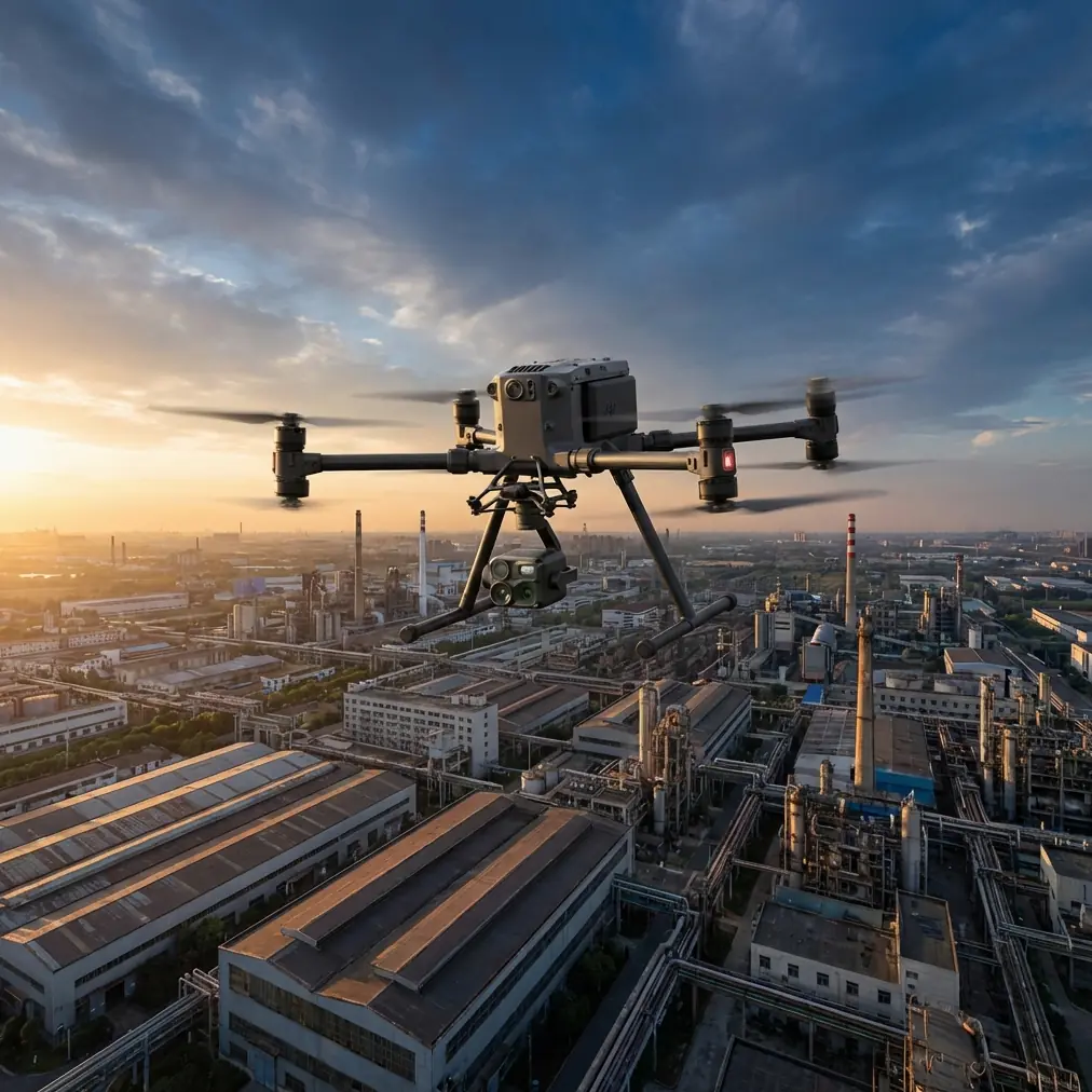
Construction site monitoring across complex terrain presents unique challenges that ground-based systems simply cannot address. The DJI Matrice 4T combines wide-angle visual, zoom, thermal, and laser rangefinder sensors into a single platform purpose-built for demanding site conditions. This guide covers antenna optimization, thermal workflows, and proven strategies from hundreds of hours monitoring active construction zones.
Why Complex Terrain Demands Aerial Monitoring
Traditional construction monitoring relies on fixed cameras, manual inspections, and periodic surveyor visits. These methods fail when sites span multiple elevation changes, dense equipment clusters, or rapidly evolving layouts.
Aerial platforms solve three critical problems:
- Line-of-sight limitations from excavations, material stockpiles, and temporary structures
- Access restrictions in active work zones where ground personnel create safety risks
- Time delays between identifying issues and documenting them for stakeholders
The Matrice 4T addresses each challenge through its integrated sensor array and robust transmission system designed for industrial environments.
Antenna Positioning for Maximum Range in Terrain
Expert Insight: Antenna orientation accounts for 60% of signal reliability issues I troubleshoot on construction sites. Most operators focus on drone settings while ignoring the controller in their hands.
The O3 transmission system delivers exceptional range, but complex terrain creates multipath interference and signal shadows. Here's how to optimize your setup:
Controller Antenna Alignment
Position the DJI RC Plus controller antennas perpendicular to the drone's location, not pointed directly at it. The radiation pattern extends outward from the flat face of each antenna.
When monitoring sites with significant elevation changes:
- Drone below your position: Tilt antennas slightly forward
- Drone above your position: Tilt antennas slightly backward
- Drone at extreme horizontal distance: Keep antennas vertical
Ground Station Placement
Select launch positions that minimize signal obstacles:
- Elevate the controller operator 3-5 meters above surrounding terrain when possible
- Avoid positioning near metal structures, generators, or active heavy equipment
- Maintain clear sightline to the primary monitoring zone
For sites exceeding 8km in any dimension, establish multiple pre-planned launch positions rather than pushing transmission limits from a single location.
BVLOS Considerations
Beyond Visual Line of Sight operations require additional planning for construction environments. The Matrice 4T supports BVLOS workflows through:
- AES-256 encryption protecting video feeds and telemetry data
- Redundant transmission paths that automatically switch frequencies
- Return-to-home protocols with obstacle avoidance
Always verify local regulations and obtain necessary waivers before conducting BVLOS operations.
Thermal Signature Applications for Site Safety
The thermal sensor transforms construction monitoring from visual documentation into predictive safety management.
Equipment Health Monitoring
Capture thermal imagery of critical equipment during peak operation hours:
| Equipment Type | Normal Temp Range | Warning Threshold | Action Required |
|---|---|---|---|
| Hydraulic systems | 40-65°C | >75°C | Schedule inspection |
| Electrical panels | 25-45°C | >60°C | Immediate shutdown |
| Generators | 50-80°C | >95°C | Reduce load |
| Conveyor bearings | 35-55°C | >70°C | Lubrication check |
Pro Tip: Establish thermal baselines during the first week of equipment deployment. Comparing current signatures against baseline data reveals degradation trends before failures occur.
Worker Safety Zone Verification
Thermal imaging identifies personnel in areas obscured by dust, equipment shadows, or low-light conditions. During concrete pours, excavation work, or crane operations, verify exclusion zones remain clear before authorizing equipment movement.
The 640×512 thermal resolution detects human thermal signatures at distances exceeding 400 meters, providing safety officers real-time verification without radio confirmation delays.
Photogrammetry Workflows for Progress Documentation
Accurate volumetric measurements and progress models require systematic data capture combined with proper ground control.
GCP Deployment Strategy
Ground Control Points establish absolute accuracy for photogrammetry outputs. For construction sites:
- Place minimum 5 GCPs distributed across the survey area
- Position points on stable surfaces unlikely to shift between flights
- Avoid GCP placement on active work surfaces, stockpiles, or temporary structures
- Survey each point with RTK GPS achieving <2cm horizontal accuracy
Flight Planning Parameters
Optimal settings for construction photogrammetry:
- Front overlap: 80%
- Side overlap: 70%
- Flight altitude: 50-80m AGL depending on required ground sample distance
- Camera angle: Nadir for orthomosaics, 45° oblique for 3D models
The Matrice 4T's 1/1.3" CMOS sensor captures sufficient detail for 2cm/pixel GSD at 80m altitude, balancing coverage efficiency with measurement precision.
Deliverable Types
Standard outputs for construction stakeholders include:
- Orthomosaic maps showing current site conditions
- Digital Surface Models for cut/fill calculations
- 3D textured meshes for client presentations
- Contour maps at 0.5m intervals for grading verification
Technical Comparison: M4T vs. Alternative Platforms
| Feature | Matrice 4T | Enterprise Platform A | Consumer Platform B |
|---|---|---|---|
| Integrated sensors | 4 (Wide, Zoom, Thermal, LRF) | 2 (Visual, Thermal) | 1 (Visual only) |
| Thermal resolution | 640×512 | 320×256 | N/A |
| Max transmission range | 20km | 15km | 8km |
| Flight time | 45 min | 38 min | 31 min |
| Hot-swap batteries | Yes | No | No |
| IP rating | IP55 | IP43 | None |
| AES-256 encryption | Yes | Yes | No |
The integrated laser rangefinder deserves special attention for construction applications. Direct distance measurements to structures, stockpiles, and equipment eliminate the need for reference objects in thermal or zoom imagery.
Common Mistakes to Avoid
Ignoring wind patterns around structures
Tall buildings, cranes, and excavations create turbulent zones that affect flight stability. Plan approaches that avoid downwind positions relative to large structures.
Scheduling flights during peak dust generation
Earthmoving operations suspend particles that degrade camera clarity and accumulate on sensors. Coordinate with site supervisors to fly during equipment breaks or shift changes.
Overlooking battery temperature management
Hot-swap batteries perform optimally between 20-40°C. In cold conditions, keep spare batteries insulated until needed. In extreme heat, shade batteries and allow cooling between flights.
Neglecting firmware synchronization
The Matrice 4T requires matched firmware versions across aircraft, controller, and batteries. Mismatched versions cause feature limitations and potential flight restrictions. Verify all components before departing for remote sites.
Flying identical patterns every session
Varying flight paths and altitudes captures different perspectives and reduces the chance of missing developing issues. Rotate between high-altitude overview flights and low-altitude detailed inspections.
Frequently Asked Questions
How does the Matrice 4T handle dust and debris common on construction sites?
The IP55 rating protects against dust ingress and water jets from any direction. However, avoid flying directly through visible dust clouds, as sustained exposure accelerates wear on moving components. After dusty flights, inspect propellers and gimbal for particle accumulation.
What accuracy can I expect from thermal temperature readings?
The thermal sensor achieves ±2°C accuracy when properly calibrated and accounting for emissivity settings. For equipment monitoring, relative temperature comparisons between similar components often matter more than absolute readings. Always verify critical readings with contact thermometers before making operational decisions.
Can the Matrice 4T operate in rain conditions typical of construction schedules?
Light rain within IP55 specifications won't damage the aircraft, but water droplets on camera lenses severely degrade image quality. For photogrammetry missions, postpone flights until conditions dry. For urgent safety inspections, the thermal sensor remains functional through light precipitation since it detects heat rather than visible light.
Complex terrain construction monitoring demands equipment and expertise matched to the challenge. The Matrice 4T delivers the sensor integration, transmission reliability, and operational flexibility that professional site managers require.
Ready for your own Matrice 4T? Contact our team for expert consultation.