Matrice 4T Vineyard Flight Plan: How to Work High
Matrice 4T Vineyard Flight Plan: How to Work High-Altitude Blocks When Weather Turns Mid-Mission
META: Expert Matrice 4T how-to for high-altitude vineyard operations, covering thermal checks, O3 transmission, hot-swap battery workflow, AES-256 security, GCP mapping, and weather-driven flight decisions.
High-altitude vineyard work exposes every weak point in a drone operation. Terrain breaks radio paths. Wind spills over ridgelines without warning. Temperature shifts can alter canopy stress patterns in less than an hour. If you are planning spraying support, scouting, or mission coordination around the Matrice 4T, those conditions are exactly where disciplined setup matters.
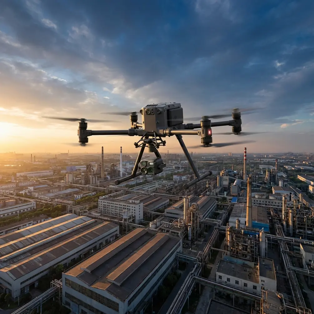
The Matrice 4T is not a spray drone in the narrow sense. It is a multi-sensor aircraft built for inspection, situational awareness, and decision support. In steep vineyard terrain, that distinction becomes valuable. Before you move liquid into the air with a dedicated application platform, you need to know what the block looks like right now, not what it looked like yesterday morning. You need to see where the canopy is uneven, where moisture is lingering, where heat is building, and whether the route you planned still makes sense after the weather shifts. That is where the Matrice 4T earns its place.
This guide focuses on one practical scenario: using the Matrice 4T to support vineyard spraying operations at elevation, especially when conditions change after takeoff.
Start With a Mission Goal, Not a Flight
The most common mistake in mountain vineyard work is launching with a vague objective. “Check the vines” is not a mission plan. For spraying support, the goal should be specific enough to produce an operational decision.
Examples include:
- identify cold pockets and wet zones before a fungicide pass
- confirm canopy uniformity across terraced rows
- verify access lanes and turning points for the spray platform
- inspect wind behavior on exposed upper blocks
- document stressed sections for follow-up treatment timing
The Matrice 4T is useful because it can combine visible imagery with thermal signature data in one flight. That matters in vineyards where visual appearance can lag behind actual plant stress. A row may look acceptable from the ground while its temperature pattern tells a different story. A hotter section can suggest water stress, reduced vigor, or exposure issues. A cooler patch at the wrong time of day may indicate retained moisture or shading effects that could influence disease pressure and spray timing.
If your goal is to support a spray decision, define the decision before propellers spin. Are you clearing a block for treatment today, delaying until wind settles, or splitting the field into zones? The data collection plan should answer that directly.
Build a High-Altitude Workflow Around Terrain Reality
Vineyards at altitude are rarely forgiving. Elevation changes compress your margin for error because the aircraft can look close on-screen while actually working across a deep contour drop. Line of sight may seem open from the launch point, then disappear as the drone slides behind a ridge shoulder.
This is where O3 transmission becomes operationally significant. Stable long-range video and telemetry links are not just comfort features in vineyard terrain. They determine whether the pilot can maintain reliable awareness as the aircraft transitions from one terrace face to another. In a valley floor field, signal performance is mostly about distance. On a mountain block, it is about geometry.
When setting up the mission:
- launch from a position with the widest possible view across contour lines
- avoid standing too low relative to the first rows you intend to inspect
- plan route legs that minimize terrain masking
- keep return paths conservative if the weather is unsettled
- identify at least one alternate recovery area before takeoff
The Matrice 4T’s transmission reliability is especially useful when the route crosses mixed exposures. South-facing rows may be clear and dry, while the leeward side of the same hill can collect gusts, moisture, or low cloud drift. The aircraft gives you a way to reassess fast, but only if your signal remains dependable through those transitions.
Use Thermal Early, and Use It With Restraint
Thermal signature data can be incredibly revealing in vineyards, but it is easy to misuse. Thermal is not magic. It shows differences, not diagnoses. In high-altitude blocks, those differences may come from airflow, slope angle, sun exposure, irrigation variation, soil depth, or disease pressure. Your job is to treat thermal as a decision layer.
For spraying support, begin with a thermal pass early in the mission, before conditions drift too far from your launch baseline. The value is in contrast. You are looking for anomalies that should shape how the day proceeds.
What to look for:
- warmer sections that may indicate stress or thinner canopy cover
- cooler pockets where moisture may persist longer
- irregular row-to-row patterns suggesting irrigation inconsistency
- edges of blocks where wind exposure changes plant behavior
- terraces that hold different temperature profiles despite similar appearance
This matters because spray performance depends on target conditions. If one upper section is already hotter and drier, while a lower shaded corner is still cool and damp, treating the block as a single uniform unit can reduce efficacy. The Matrice 4T helps you divide the site into real operational zones.
A practical note: thermal interpretation gets cleaner when paired with visual confirmation. If a hot patch appears in the thermal view, switch immediately to the visible sensor and inspect canopy density, row continuity, and surrounding terrain. That cross-check prevents hasty assumptions.
Why Photogrammetry and GCPs Still Matter in a Spray-Support Mission
Some operators treat photogrammetry as a separate mapping task, disconnected from day-to-day field work. In steep vineyards, that is a mistake. Photogrammetry creates the spatial understanding that makes tactical flights more useful.
If you are building a treatment support workflow around the Matrice 4T, use periodic mapping runs to keep your terrain model honest. Terraces, erosion edges, service tracks, retaining walls, and drainage paths all influence how a spraying plan should be executed. Ground control points, or GCPs, improve positional reliability when you need repeatable comparisons over time.
Operationally, that gives you two advantages.
First, you can revisit the same trouble spots with better precision. If a thermal anomaly appears on the upper western block this week, GCP-backed mapping makes it easier to inspect the exact same section after treatment or after a weather event.
Second, you can align route planning with real topography instead of rough visual memory. On a steep vineyard, a few meters of positional error can place the aircraft over the wrong terrace or misrepresent a hazard boundary. That is not a minor issue when crews, equipment, and treatment timing depend on the output.
The Matrice 4T is often discussed for its sensors, but in field practice the real advantage is how those sensors fit into a repeatable operational workflow. Photogrammetry and thermal together give context and urgency. One tells you where things are with confidence; the other tells you where to pay attention first.
What Happened When the Weather Changed Mid-Flight
Here is the scenario that tends to separate routine flying from useful professional work.
You launch in stable morning conditions on a high-altitude vineyard. The lower rows are calm. Visibility is clean. Thermal pass begins normally, and the first few terraces show a predictable gradient: cooler in the shaded lower band, warmer toward the exposed upper slope. Then, halfway through the mission, the weather shifts.
A crosswind starts spilling over the ridgeline. Not violent, but enough to push the aircraft slightly off its previous track. At nearly the same time, a cloud bank cuts direct sun on one side of the block. The canopy temperature contrast that looked sharp ten minutes earlier begins to flatten in some sections and intensify in others. If you keep flying as if nothing changed, your interpretation becomes unreliable.
This is where the Matrice 4T’s value is less about one headline feature and more about composure under changing conditions.
The response should be deliberate:
- pause the original inspection sequence
- check aircraft stability and link quality
- verify the O3 transmission remains solid across the route
- compare live visible and thermal views for changing interpretation
- shorten the remaining route if the ridge wind continues building
- prioritize the decision-critical areas first
If batteries are nearing the change point, this is where hot-swap battery workflow matters. On a mountain vineyard, weather windows can narrow quickly. Being able to swap power efficiently and relaunch without a slow reset cycle preserves continuity. That is not just convenient. It can mean the difference between finishing the assessment while conditions are still interpretable and losing the day’s decision window.
During a real vineyard operation, a mid-flight weather change often forces a ranking exercise. You may no longer have time to scan every row with the same level of detail. So focus on the zones that change operational outcomes: exposed crest rows, disease-prone low pockets, and any section already flagged by thermal irregularity.
In other words, do not chase completeness when weather is removing data quality. Chase usefulness.
Protect the Data, Especially on Sensitive Agricultural Sites
Commercial vineyards increasingly treat agronomic data as business-sensitive information. That makes secure transmission and device handling more relevant than many operators admit.
AES-256 matters here because reconnaissance flights can reveal more than plant health. They can expose irrigation layouts, access roads, work patterns, and treatment schedules. If you are flying for a vineyard group, estate manager, or contracted agronomy team, secure handling is part of professionalism, not an IT afterthought.
Good practice includes:
- encrypting mission data during transfer and storage
- limiting who has access to thermal and mapping outputs
- keeping field tablets and controllers updated
- separating client data by project
- documenting who received imagery and when
This becomes even more important if your operation is building toward BVLOS procedures in the future. Longer-range workflows raise both operational opportunity and compliance pressure. Even when full BVLOS deployment is not in play, building disciplined security habits around the Matrice 4T now makes expansion easier later.
A Practical Flight Sequence for Vineyard Spraying Support
If you want a field-ready approach, use this sequence.
First, map the block boundaries and hazard points before the day of treatment. Include terraces, poles, access lanes, trees, netting zones, and likely signal shadows. If accuracy matters for repeat surveys, use GCPs.
Second, launch early enough to capture meaningful thermal contrast, but not so early that dew or unstable morning inversion completely skews the reading. Your target is actionable difference, not dramatic imagery.
Third, run a short orientation leg to validate O3 link quality against the terrain. If the ridgeline or tree line is already affecting signal confidence, redesign the route before proceeding deeper into the block.
Fourth, collect thermal and visible imagery over the sections most likely to alter the spraying plan. Upper exposed rows, low moisture-retaining corners, and transition zones between slope aspects deserve priority.
Fifth, if weather shifts mid-mission, do not stubbornly finish the original route. Reassess. Preserve the value of the flight rather than the shape of the plan.
Sixth, land, review, and convert observations into a simple spray-support decision: proceed, delay, split into zones, or inspect again later.
That last step is where many operators lose the plot. A drone mission is not useful because it flew successfully. It is useful because someone can act on the result.
When to Escalate Beyond a Basic Inspection
There are cases where a Matrice 4T support flight should trigger a deeper response before any spray platform goes out.
Examples include:
- thermal anomalies repeating in the same terrace after irrigation adjustments
- unexpected cool pockets suggesting persistent moisture risk
- wind effects creating obvious treatment inconsistency risk on upper rows
- inaccessible sections where visual ground checks would be slow or unsafe
- repeated link degradation pointing to a poor launch location or route design
In those cases, a quick field conversation is more valuable than a perfect report. If you need a practical sounding board for route design or vineyard-specific drone planning, you can reach out here: https://wa.me/example
The Real Role of the Matrice 4T in Vineyard Operations
For high-altitude vineyards, the Matrice 4T should be viewed as an intelligence platform that sharpens treatment decisions. It is not replacing agronomy judgment. It is not replacing a dedicated spray aircraft. It is reducing guesswork in the narrow window where weather, terrain, and crop condition collide.
That is especially true when the weather changes during the mission. A rigid operator sees disruption. A good operator sees new information and adjusts. If ridge wind arrives halfway through the inspection, if cloud cover changes the thermal picture, if battery timing tightens, the aircraft still gives you a stable way to re-prioritize and finish the work that matters most.
That is the difference between flying a drone over a vineyard and using the Matrice 4T well.
Ready for your own Matrice 4T? Contact our team for expert consultation.